The United States developed the bomb through the Manhattan Project and sent the B-29 Enola Gay from Tinian with the uranium bomb Little Boy. Hiroshima contained military headquarters and transport infrastructure within an inhabited city. The mission’s aiming point was the Aioi Bridge.
- Morning
Students at work
As the workday began, mobilized students were among those clearing buildings. Their assignments took many of them into exposed areas near the city center.
- 8:15 a.m.
Airburst over central Hiroshima
The bomb exploded about 600 meters above the city. The location directly beneath an airburst is called the hypocenter. Heat, blast, and radiation exposed people in different ways depending on where they were and what sheltered them.
- Hours later
Fire and the search for help
Fires spread through damaged neighborhoods. Survivors searched for water, relatives, and treatment while medical workers faced a disaster that had also struck hospitals and their staff. Dark rain fell in some areas after the blast.
- By December
About 140,000 deaths
Hiroshima’s estimate includes people who died from injuries and acute radiation effects in the weeks and months that followed. The exact total is unknown.
- U.S. National Park Service · Timeline of both missions
- U.S. National Archives · Records of the atomic bombings
- City of Hiroshima · The realities of the bombing
- Hiroshima Prefecture · Bombing and reconstruction
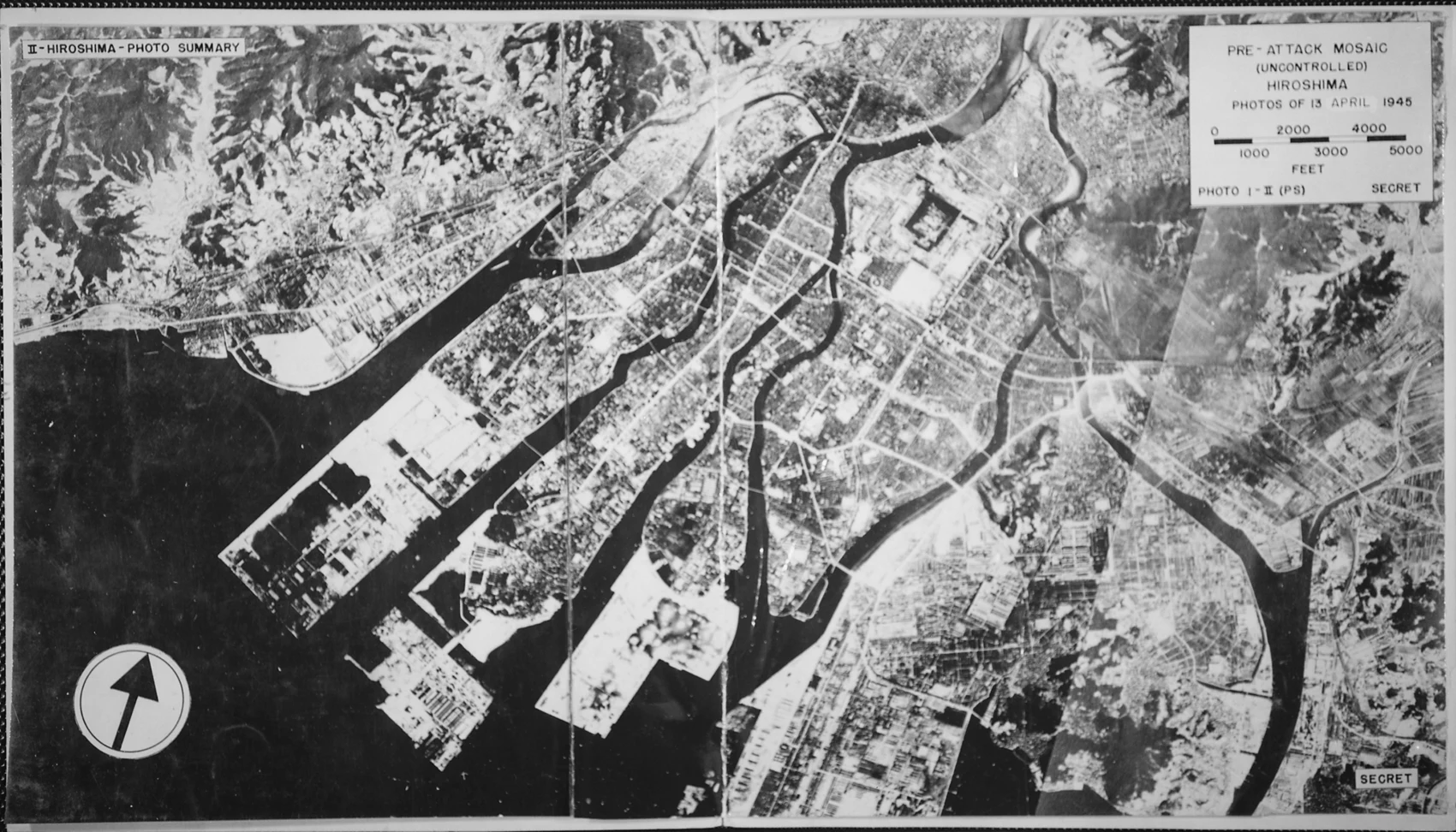

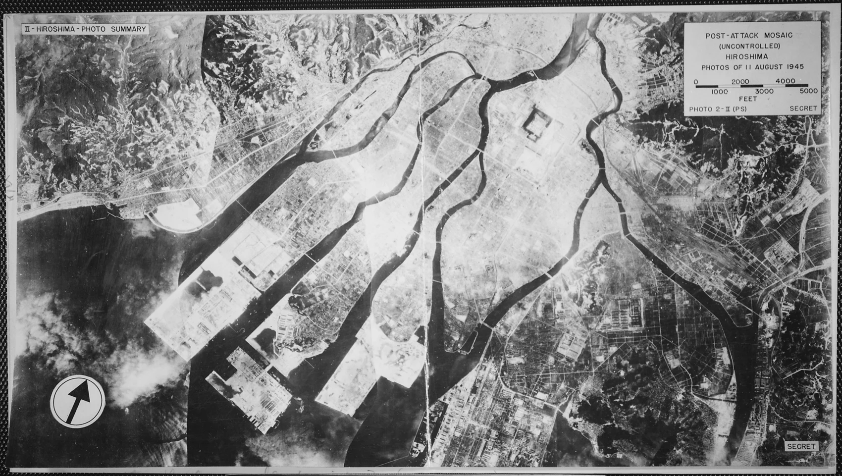

Where the aircraft aimed and where the bomb exploded
Aioi Bridge’s distinctive junction made it visible from above. The bomb detonated southeast of the bridge, above the Shima Hospital area. The aiming point, airburst and hypocenter answer three different questions about the same event. Keep that distinction in mind when reading a mission log alongside a local account.
The National Park Service chronology uses Tinian time, one hour ahead of Hiroshima. That is why its entries around 9:15 correspond to the 8:15 remembered in Japan. The Hiroshima timeline on this site uses local time.
The two U.S. aerial mosaics are useful for tracing damage across the built environment. Follow a riverbank and a bridge between the two photographs, then look at the blocks beside them. For details at street level, turn to the city’s collections and civilian testimony. The aerial record cannot tell you who was inside a building or what happened after people left it.